
Le Grand Départ Stage 2, Holmfirth to High Bradfield via Langsett
Stage 2 starts on Sunday July 6th at York and finishes in Sheffield and passes through Langsett, 4 miles from Penistone. The map below joins the route at Holmfirth and goes through to High Bradfield. All places are easily reached from the centre of Penistone, the furthest point being Woodhead reservoir, 11 miles away.
You can also follow the stretch below in Street View and take a virtual tour of the area (opens in new window). You can also view a larger, printable version of this Google map by clicking here where
If you're not familiar with Street View, click here for a quick guide.
Please note that the route is for guidance only and may change nearer the date. If you spot any errors please notify us and we will make corrections as soon as possible.
Holmfirth - Bradfield: 23.5 miles, 44 minutes by car
HOLMIRTH
A6024 Starts as Huddersfield Rd; becomes Woodhead Rd. Leads to...
WOODHEAD
A628 The main Manchester road. Leads to...
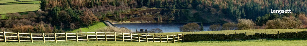
LANGSETT
A616 The main Sheffield Road;
Mortimer Road. Continue through...
MIDHOPSTONES
Mortimer Road. Continue to...
BRADFIELD
Mortimer Road; Penistone Road. leads to...
HIGH BRADFIELD
Woodhead to Bradfield - timelapse video
This video was created using images from Google Street View and gives you an idea of a competitor's eye view.
Places on or close to the route
Holmfirth, Woodhead, Bord Hill, Langsett, Langsett reservoir, Underbank reservoir, Midhopestone, Midhope reservoir, Agden reservoir, High Bradfield.
Place nearby (distances from Langsett):
Millhouse Green (2.2 miles), Thurlstone (3 miles), Penistone (4.4 miles), Winscar reservoir / Dunford Bridge (6.5 miles), Carlecotes (4.0 miles), Hade Edge (6.6 miles), Hepworth (5.7 miles), Huddersfield (13.1 miles), Shelley (9.2 miles), Skelmanthorpe (9.8 miles), Scisset (10.1 miles), Totties (6.8 miles), Jackson Bridge, (6.0 miles), Scholes (6.5 miles), Cawthorne (8.7 miles), Hoylandswaine (5.5 miles), Stocksbrdige (4.0 miles), Sheffield (14.6 miles).
The full route for both stages 1 and 2 including interactive maps can be found on the Welcome to Yorkshire official site, http://letour.yorkshire.com.
Accommodation Map
Numerous towns and villages are located within easy reach of Langsett and Penistone, each with its unique character.
Click here to view the Accommodation map.
Nearby Places Map
Need a place to stay? The map below features a selection of accommodation providers in the area.
Click here to view theTowns & Villages map.
Food and Drink
Staying in self-catering accommodation and too busy to cook? Find your nearest restaurant, takeway, café or pub here!
Click here to view the Food & Drink map.
Attractions Map
There's plenty to see and do in the area. Here's a selection of attractions and things to do in the days leading up to the event.
Click here to view the Attractions map.